App Features
Whether you are conducting a full scale GNSS survey with high precision instruments, need to collect large amount of location based data using nothing but your phone, or just need to view a few shapefiles with labels over a background map on the go, SW Maps has it all covered.
Layers and Overlays
Overlay multiple mbtiles, KML files, shapefiles and more!
Data collection
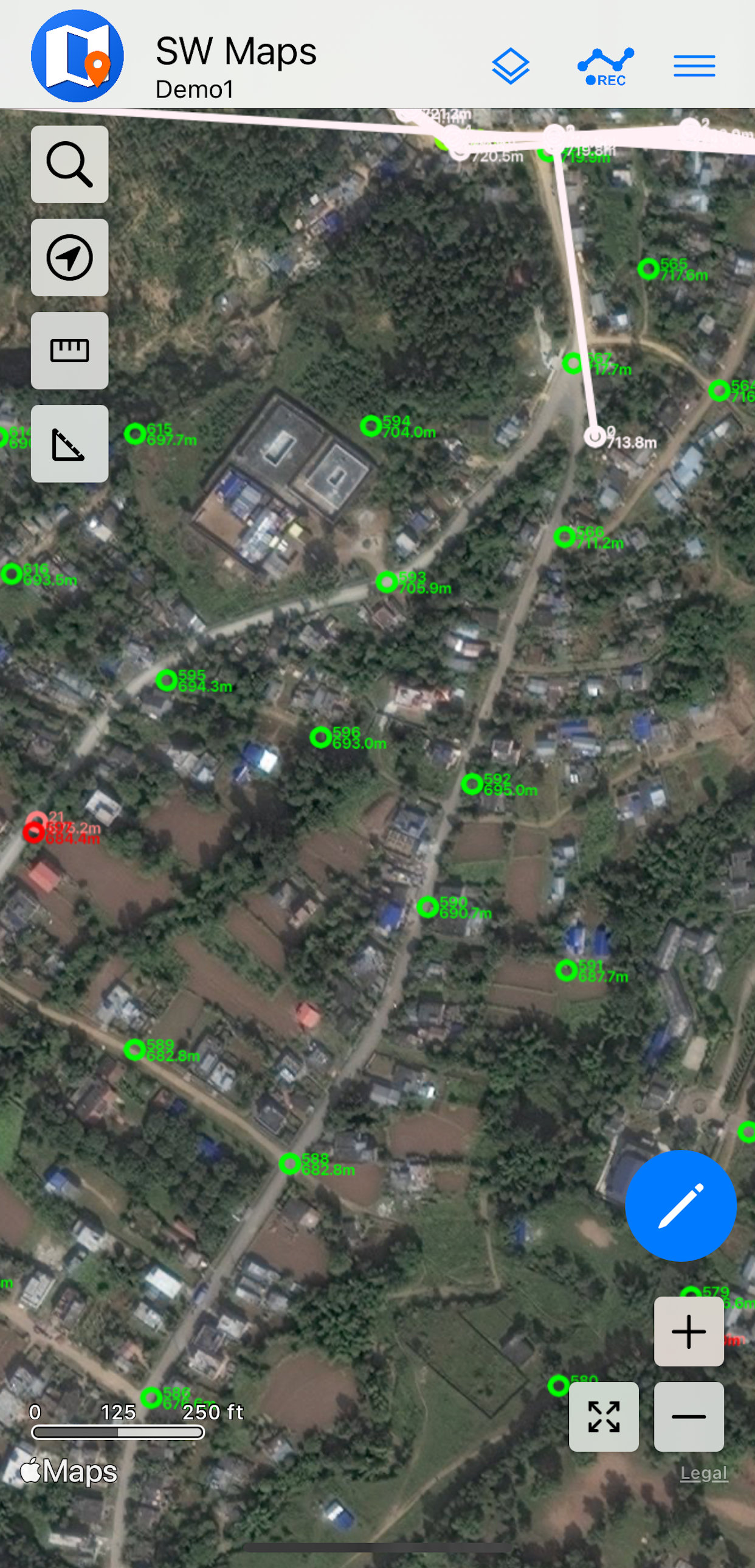
Record or draw points, lines and polygon features along with user defined attributes and photos.
Export, Import and Share
Export and share your collected data to multiple formats, including KMZ, Geopackage, and Spreadsheets
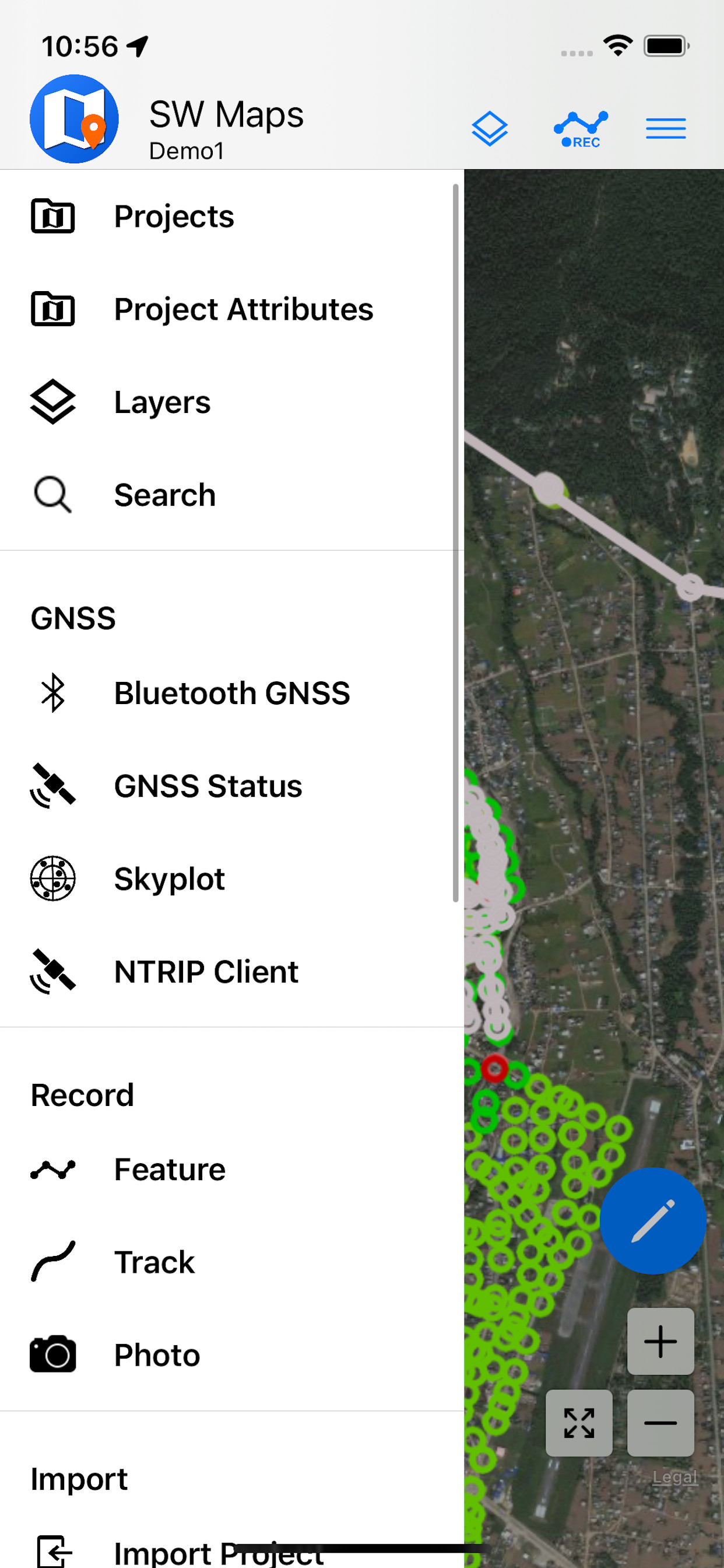
GNSS Receiver Connection
Connect to external GNSS receivers for high accuracy surveying using RTK or PPP. Also has built-in NTRIP Client!
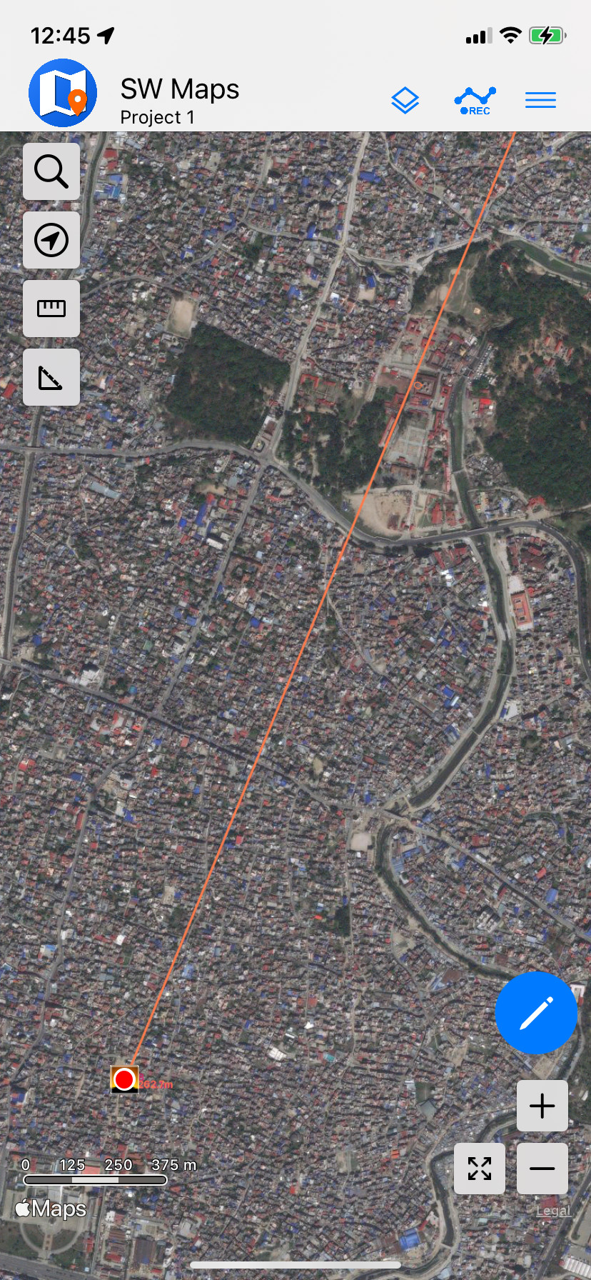
Tracks
Record GPS tracks, with distance measurement.
Templates
Load templates containing predefined feature layers when creating projects, and share existing projects as templates.

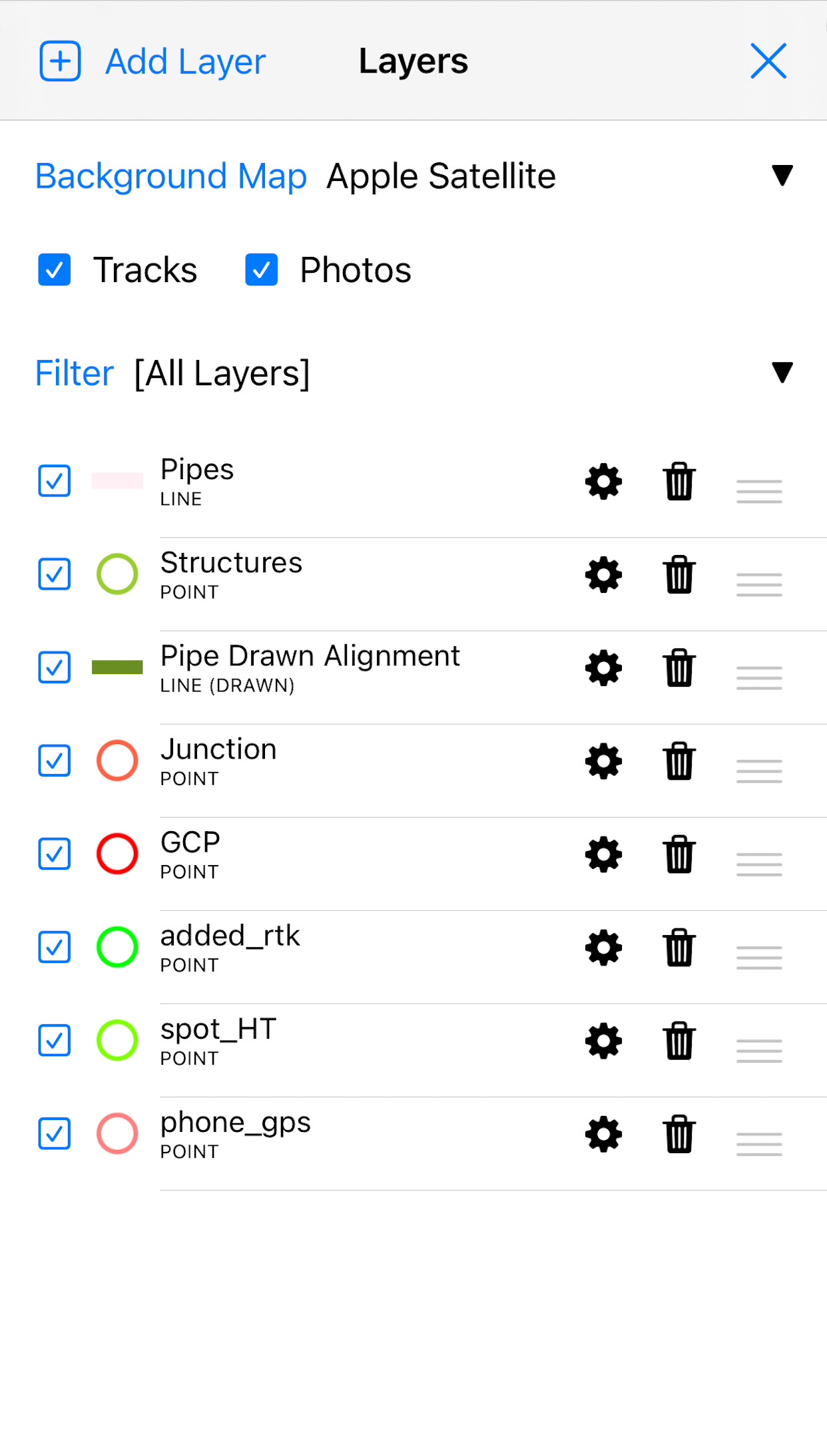
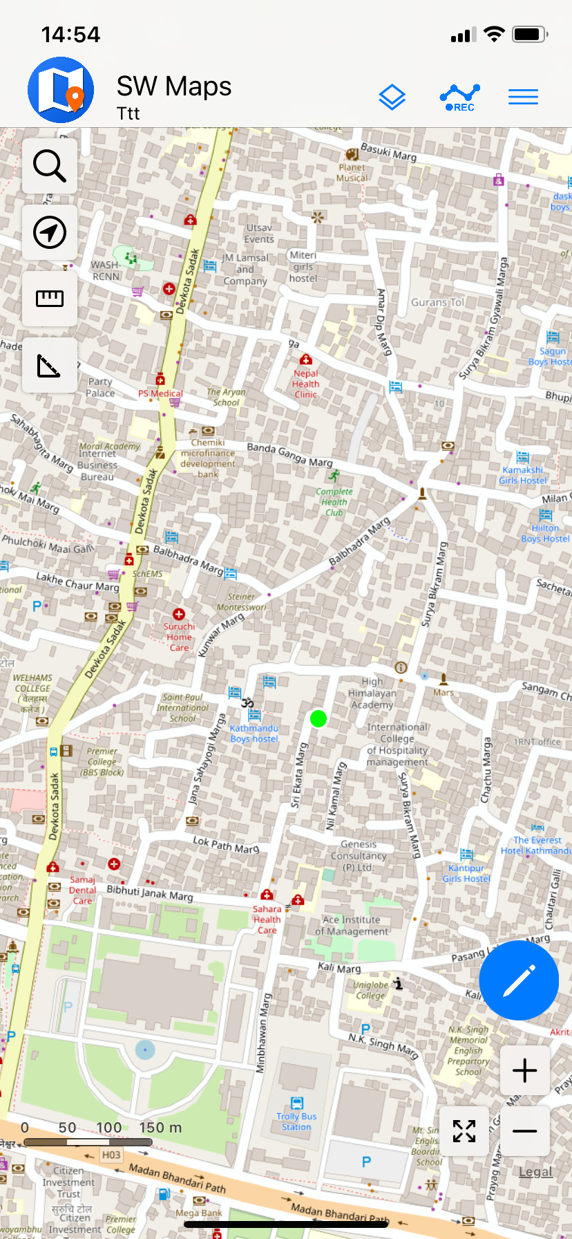
Load Your Own Maps!
Overlay multiple mbtiles, KML files, shapefiles and more, over Google Maps™ (Android)/Apple Maps™ (iOS) and OpenStreetMap™ online basemap
- Raster Mbtiles layers, for offline maps and high resolution aerial imagery.
- KML Files
- Shapefiles, Geopackages and GeoJSON files with categorized styling and labeling
- Connect to your own WMS/WMTS/TMS/XYZ servers for online maps
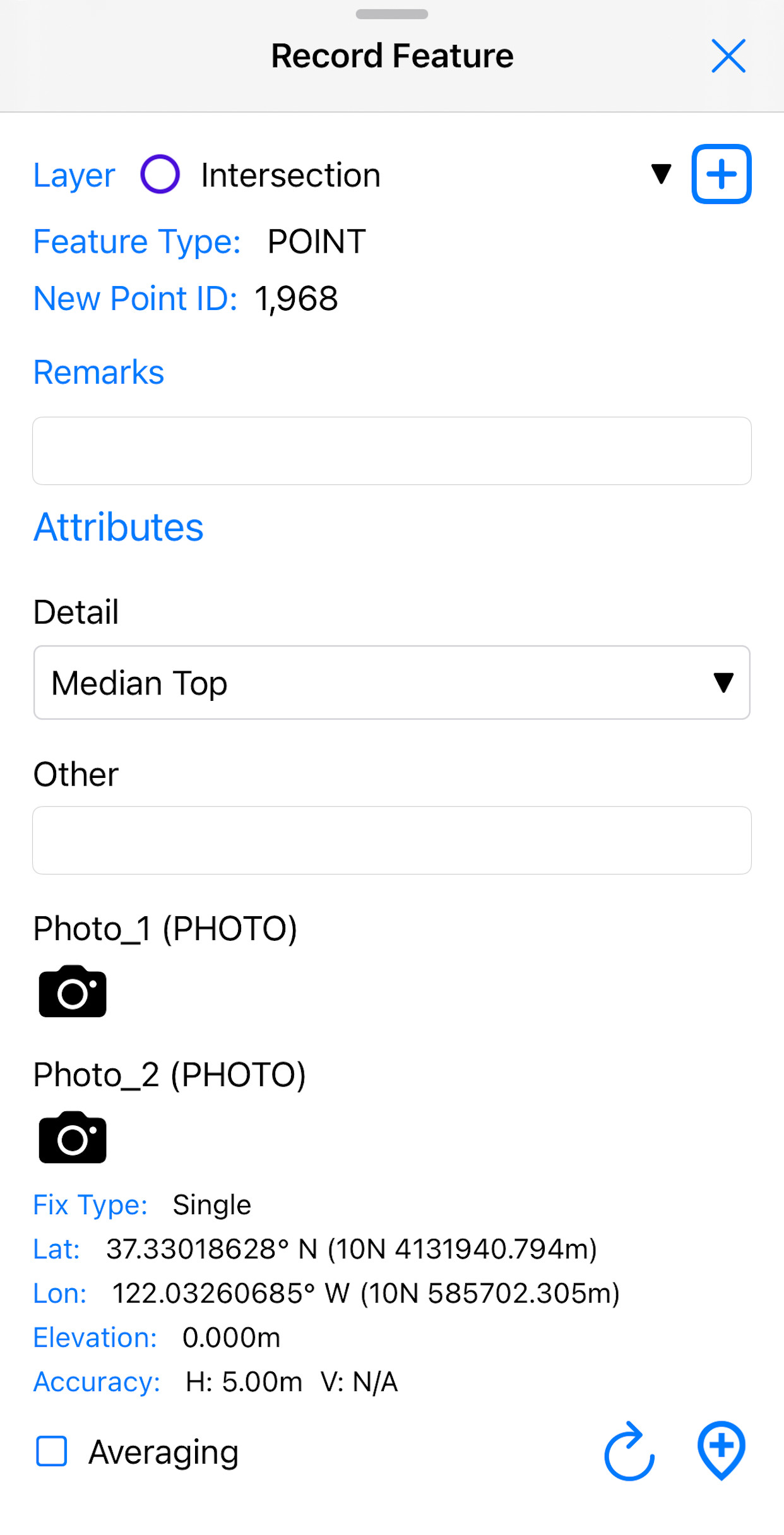
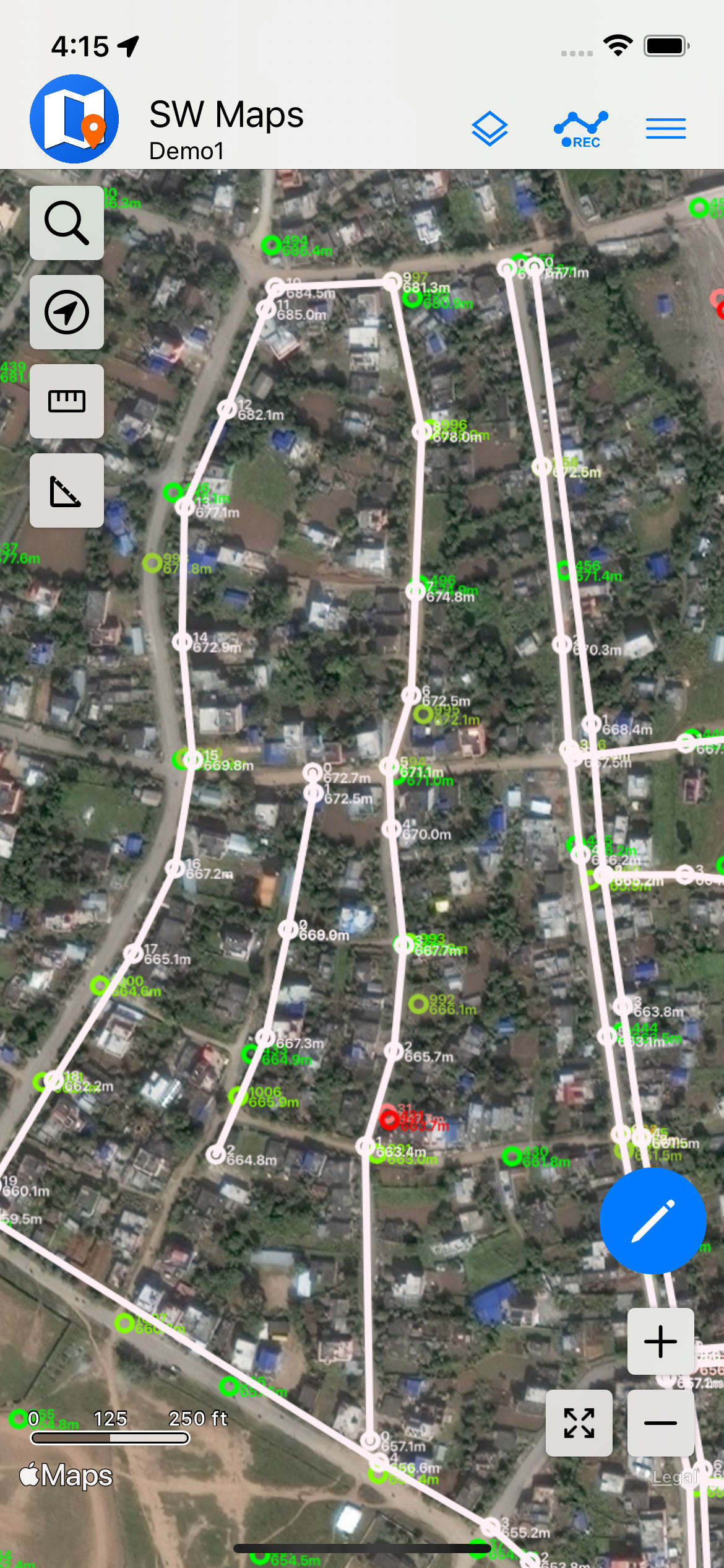
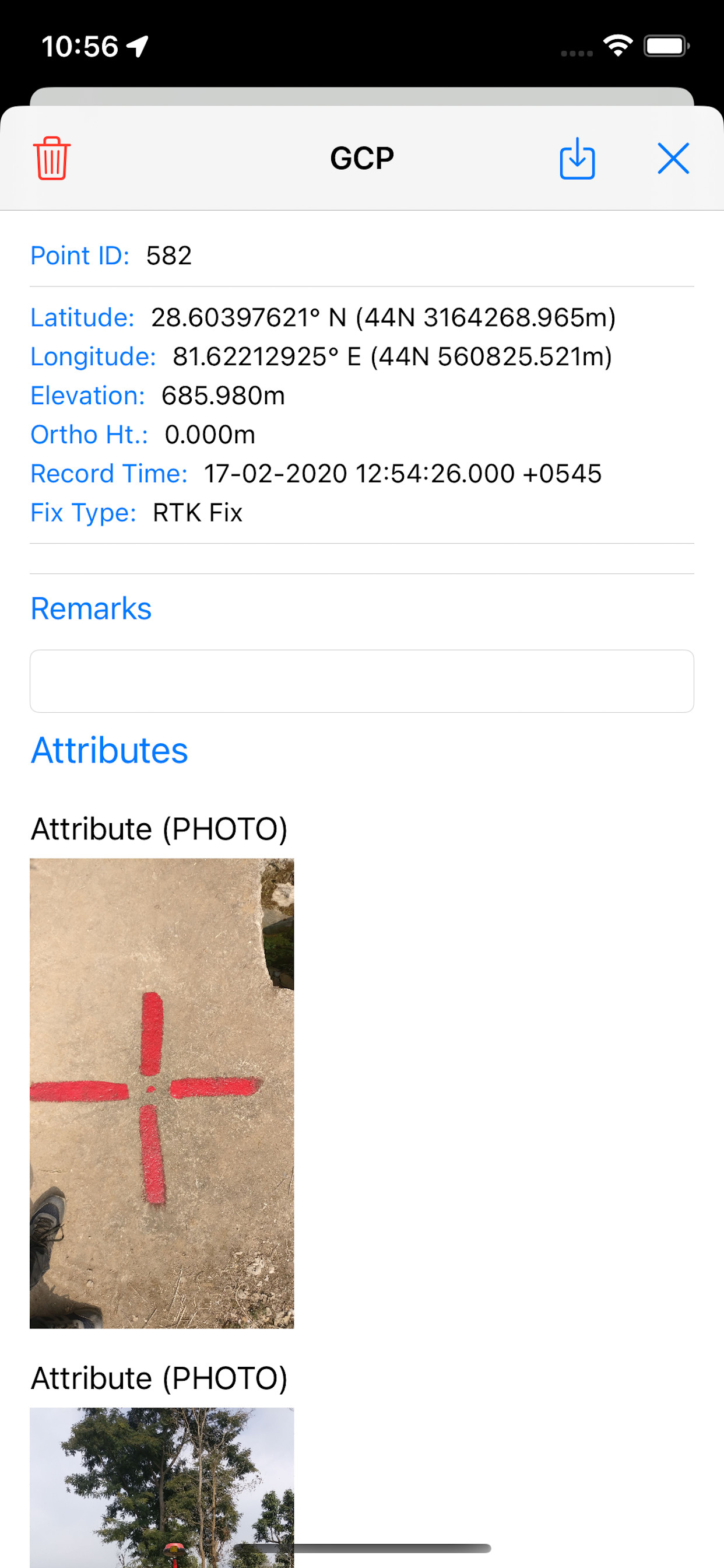
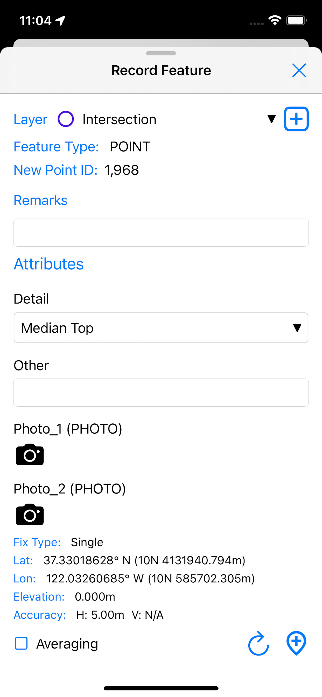
Data Collection
Record or draw points, lines and polygon features along with user defined attributes and photos.
- Record or draw points, lines and polygon features.
- Create custom attribute forms with Text, Numeric, Drop down Options, Photos, Audio, Video fields.
- Save your layers as a template for re-use or sharing.
- Create projects from templates for standardized data collection with large teams.
- Define your own layer style and label field.
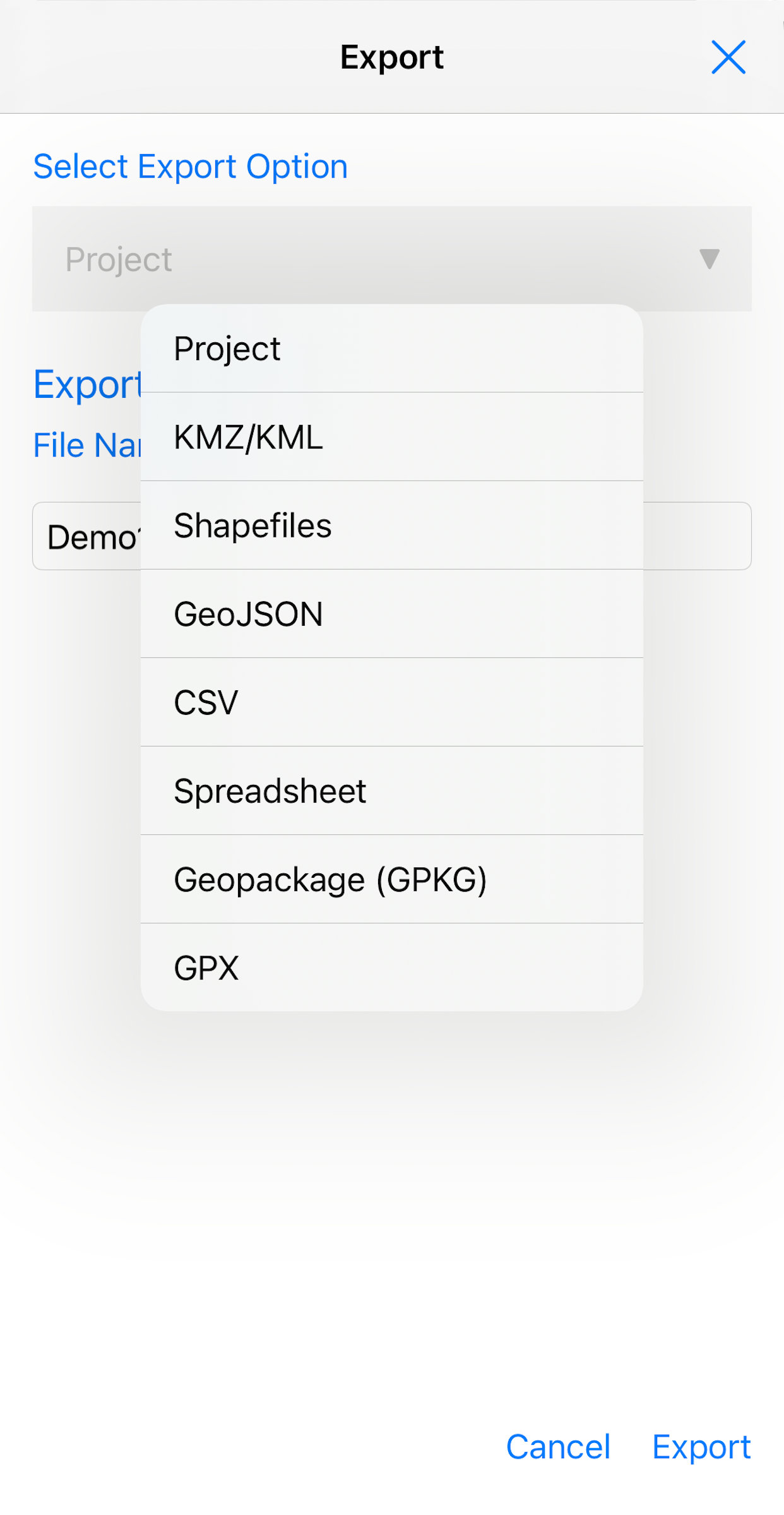
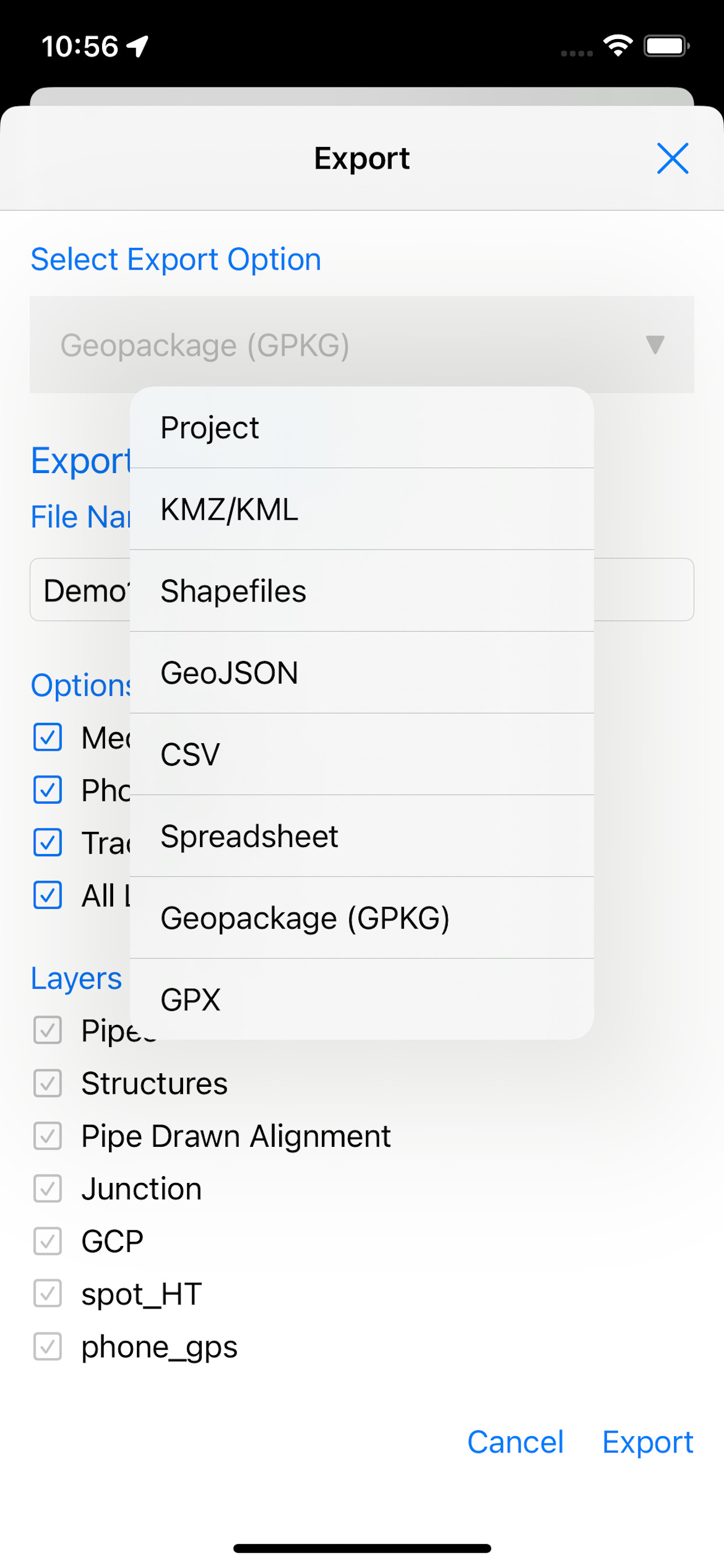
Share and Export Your Data
Collected data can be exported from SW Maps to multiple formats.
- KML/KMZ files, with photos
- Shapefiles
- Geopackage
- CSV
- Spreadsheets (Excel/ODS)
- GeoJSON
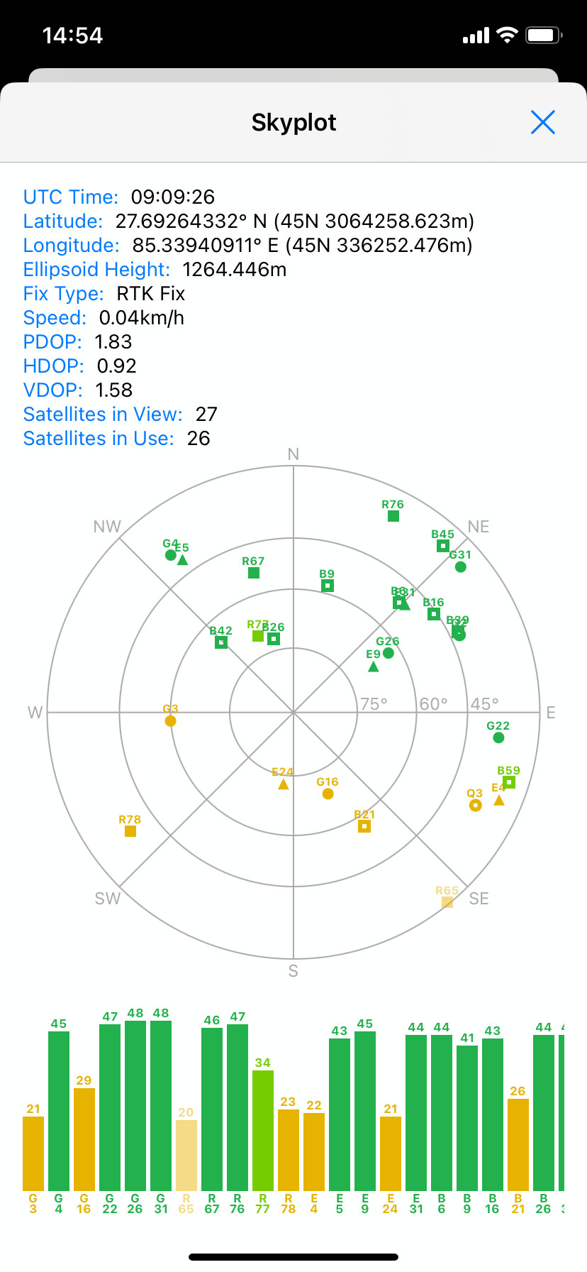
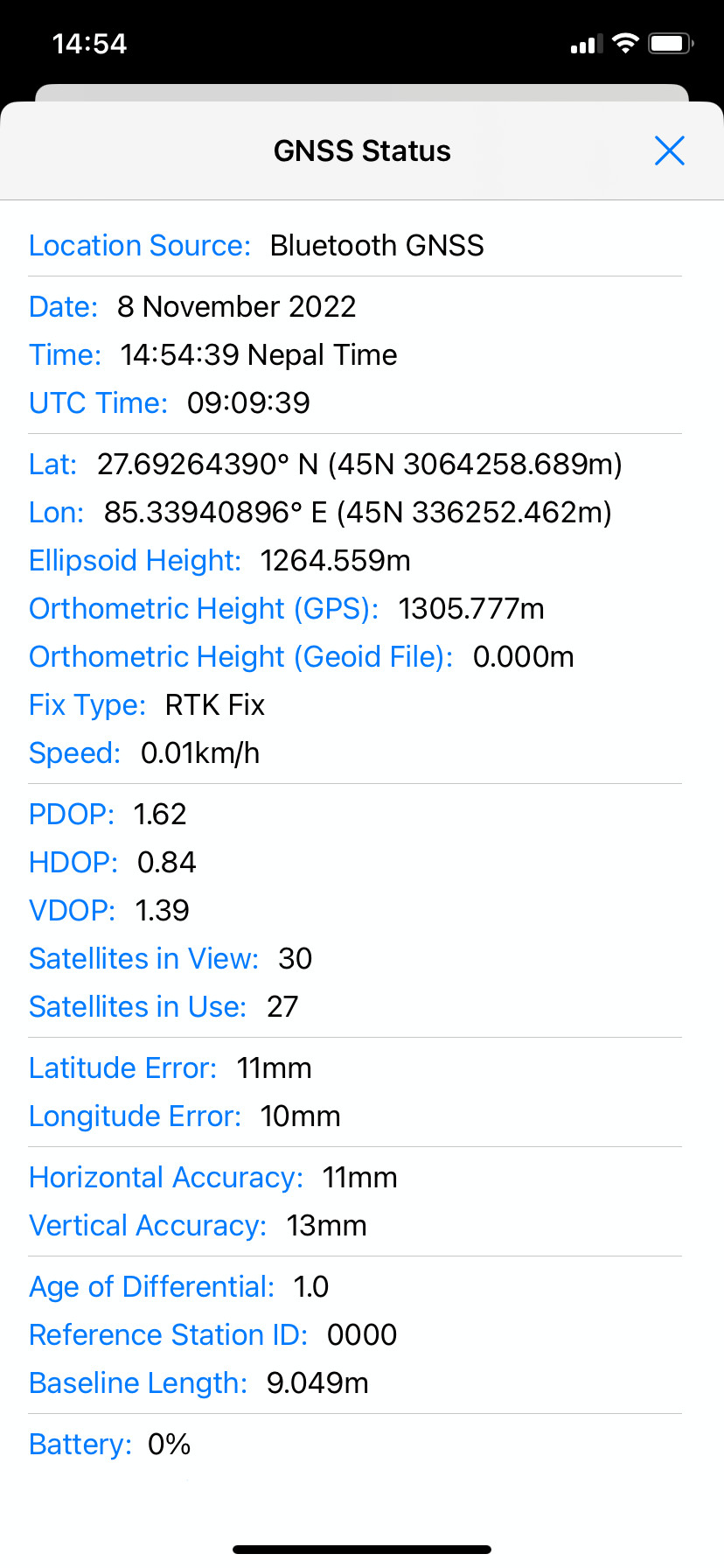
Connect External GNSS Receivers
SW Maps supports connecting to external GNSS receivers, so you can use it for all your high accuracy surveys.
- Connect to external GNSS Receivers using Bluetooth (Android/iOS) or USB-OTG (Android Only)
- Built-in NTRIP client for use with low-cost RTK GNSS Receivers
- Compatible with all GNSS receivers with NMEA output support
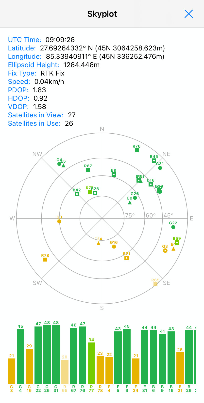
- Skyplot and GNSS accuracy display
- Record raw data from external GNSS receivers for post-processing
- Support custom GTX geoids
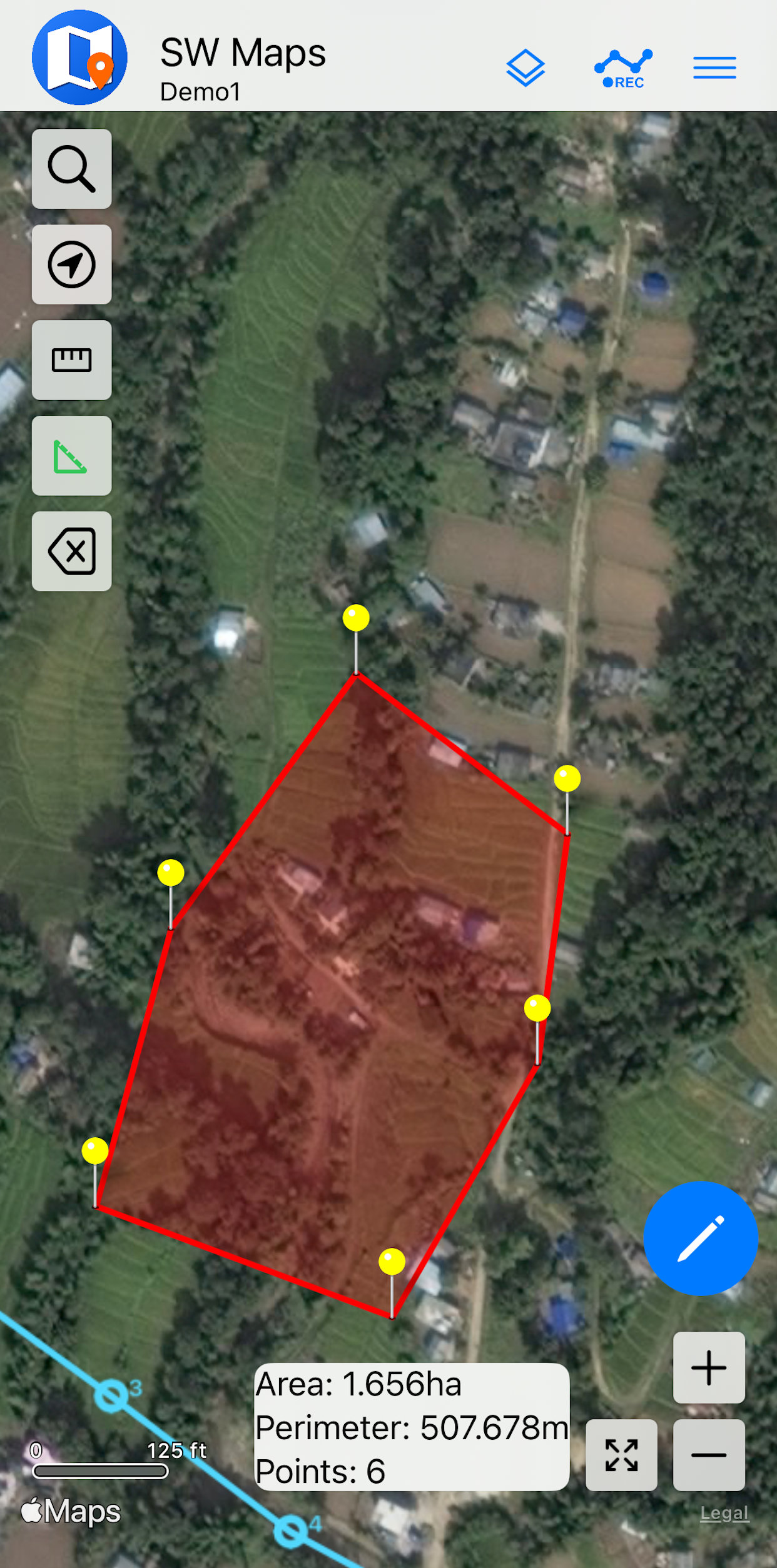
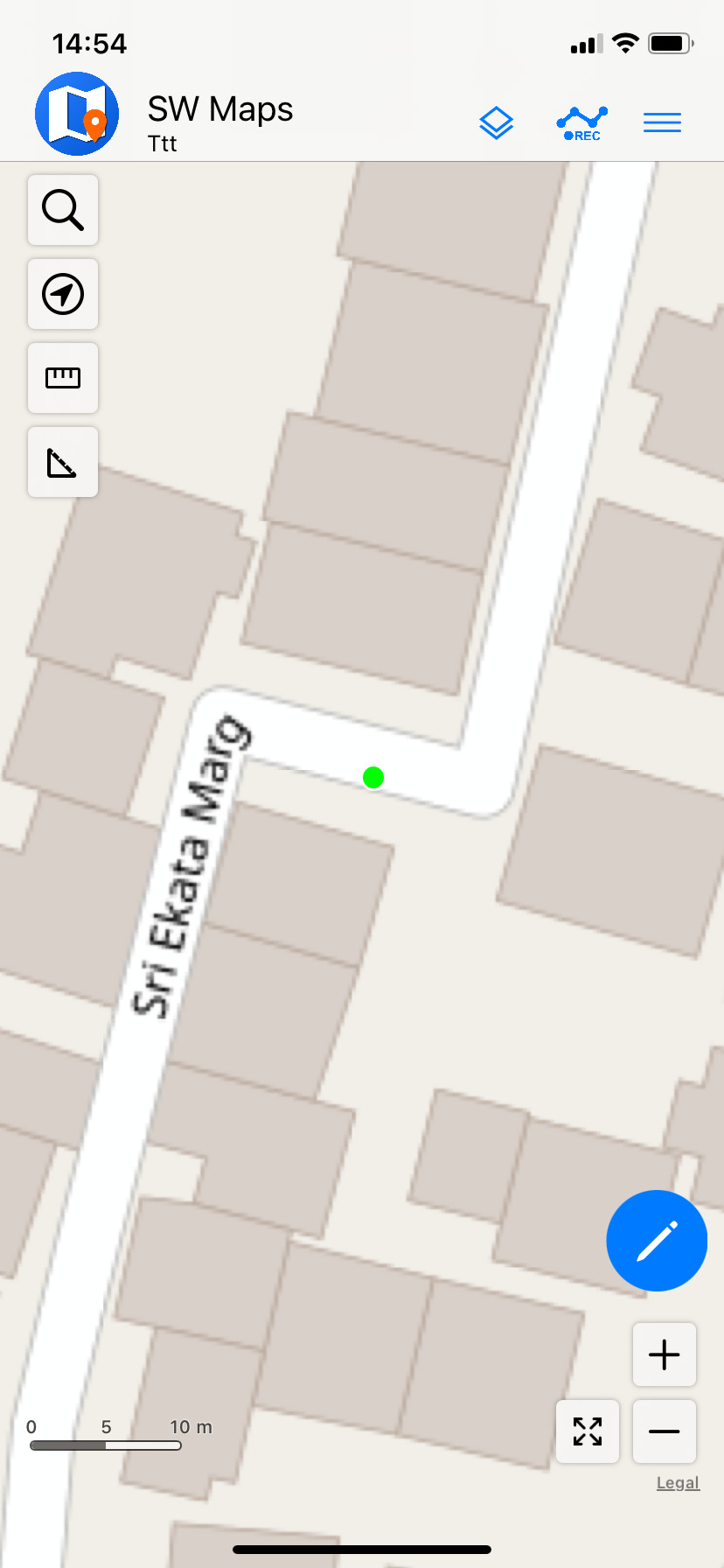
Measurement Tools
Interactive measurement tools to measure lengths and areas on the map.
- Draw and measure length of lines and polylines
- Draw and measure area and perimeter of polygons
- Shows lengths and areas of all recorded features, and distance from current location
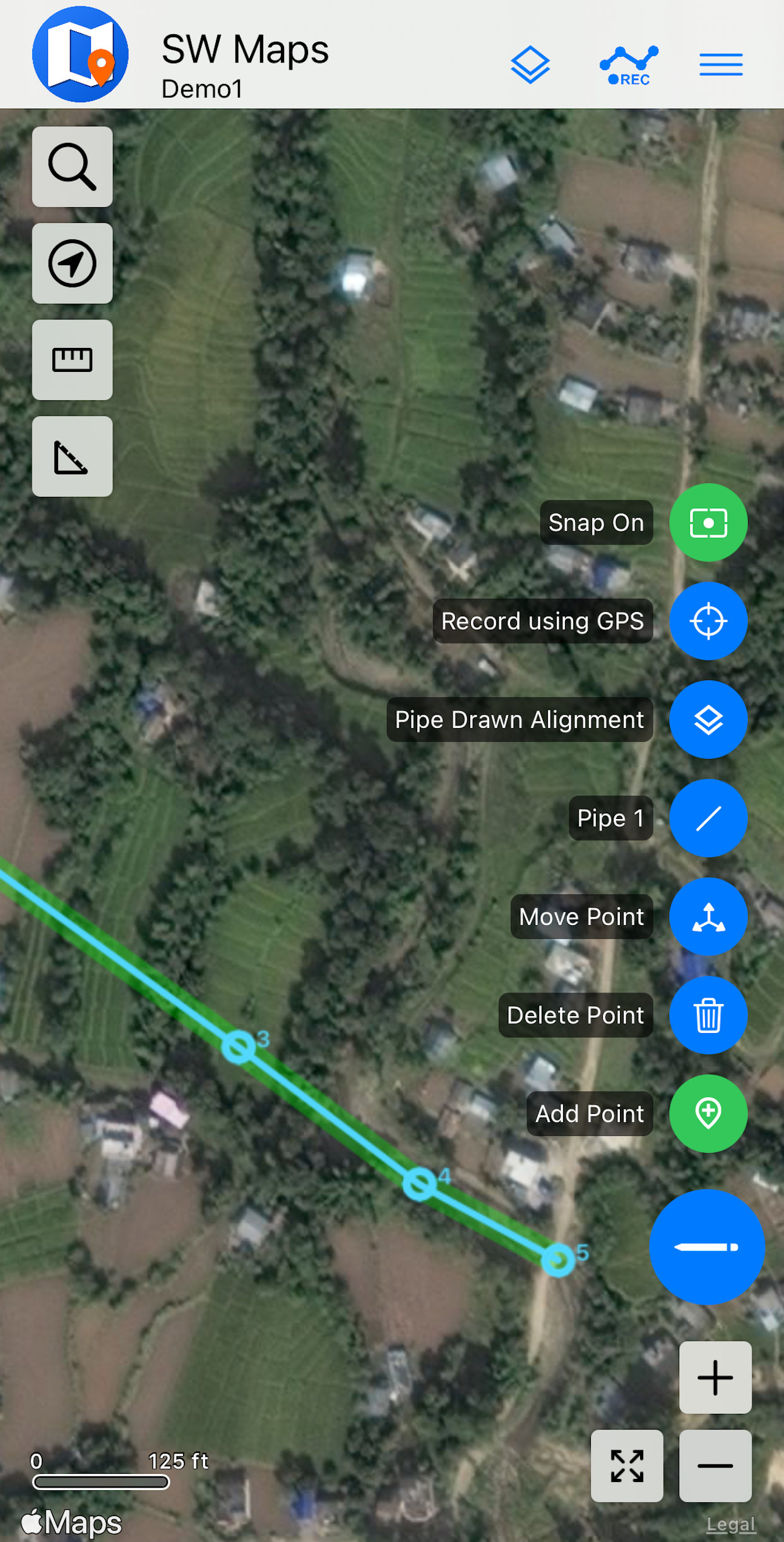
Advanced Drawing Tools
Drawing and editing tools for marking and digitization.
- Draw, move and edit point, line and polygon features on the map
- Snap to existing features, and imported vector layers
- Quickly switch between drawing points and recording using GNSS
Gallery
Licensing
SW Maps is a completely FREE app, and contains no ads! You can use it for all your commercial or non-commercial applications with no restrictions.
Please refer to our Privacy Policy and Terms of Use for more details.
If you would like to develop customized applications based on SW Maps for your organization, please contact us.
Frequently Asked Questions
-
Which co-ordinate system does SW Maps use?
All data recorded and exported by SW Maps is in the WGS84 geographic coordinate system (EPSG:4326). SW Maps supports exporting point coordinates in Universal Transverse Mercator (UTM) in Spreadsheets and CSV format. For importing shapefiles, geopackage and WMS layers, SW Maps uses the PROJ library to support most coordinate systems.
-
Which NMEA sentences does SW Maps use? Why can't I
see the GNSS skyplot and accuracy?
SW Maps uses the NMEA GGA and RMC sentences for position and time, GSA and GSV sentences for skyplot display, and the GST sentence for accuracy. Enable these messages in your receiver.
-
How can I zoom the map in closer?
The default online base maps used by SW Maps has limited maximum zoom. If you have high resolution imagery layers, or are collecting points very close to each other, you'll want to zoom in further on the map.
If you are on Android, go to Settings and enable the experimental "Drawing Mode". This will turn off the basemap and let you zoom in further.
On iOS, simply set the background map to "None".
-
How do I add my own file layers to SW Maps?
SW Maps layers are added by copying the files to the corresponding layer folder on your device. There is one folder for every layer type.
For Android 10 and earlier: "SW_Maps/Maps" folder on your device storage.
For Android 11 and later: "Android/media/np.com.softwel.swmaps/Maps" folder on your device storage.
For iOS: Open Files app, and open "On My iPhone". Then, go to "SW Maps/Layers"
-
How do I open the NTRIP Client?
To open the NTRIP client on Android, you need to be connected to a GNSS receiver with a compatible instrument profile. Then, you can open the NTRIP client from the left navigation drawer.
-
How do I load a Geoid File?
SW Maps uses binary GTX Geoid files. The Geoid file must contain the geoid height from the WGS84 ellipsoid, in meters.
-
How do I prevent low accuracy data being recorded?
You can set the minimum GNSS fix quality for recording in the app settings. This will prevent recording of low quality data. For example, setting minimum fix quality to RTK Fix will prevent RTK float points from being recorded.